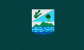
Monte Cristi Province (Provincia de Monte Cristi)
 |
 |
Montecristi is where the Duarte Highway ends, which runs through the country from South to North from the city of Santo Domingo. Additionally, the province has a network of secondary roads that interconnect the city of San Fernando de Montecristi with the other municipalities and surrounding provinces.
Monte Cristi was founded by Nicolás de Ovando in 1506 and populated in 1533 by Juan de Bolaños and 63 families from the Canary Islands. These migrated to various parts of the country afterwards leaving the town behind. It was later repopulated and became a wealthy port in the mid-to-late 16th century. In 1606, one hundred years after its founding, it was destroyed as retribution for doing business with pirates. In 1756 the city was rebuilt and again became a prosperous trading center, until the early 20th century. Monte Cristi had a boom period in the last quarter of the 1800s.
The town was at the forefront in many of the advances including the first aqueduct, first railroad and telephone. The great task of diverting the course of the Yaque del Norte River was undertaken, which had lost its initial course when the cataclysm of 1802. The town attracted people not only from Santo Domingo, Santiago, Puerto Plata and other communities, but also foreigners (English, French, Spanish, Chinese, Americans, South Americans and islanders from the other Antilles). In 1895, it was the site of the signing of the Manifesto of Montecristi by Máximo Gómez and José Martí, at the Gómez home on Mella St. They sailed from "La Granja" beach, also in Montecristi, to Cuba to fight for its independence.
The economic decline of Monte Cristi began with the decrease in the demand for raw materials in Europe, difficulties of the Casa Jiménez, which the dictator Ulises Hereaux forced to escape from the hands of his political rival, Juan Isidro Jiménez, and then the problems derived from World War I.
Map - Monte Cristi Province (Provincia de Monte Cristi)
Map


Country - Dominican_Republic
 |
 |
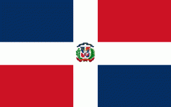
| Flag of the Dominican Republic | |
The native Taíno people had inhabited Hispaniola before the arrival of Europeans, dividing it into five chiefdoms. They had constructed an advanced farming and hunting society, and were in the process of becoming an organized civilization. The Taínos also inhabited Cuba, Jamaica, Puerto Rico, and the Bahamas. The Genoese mariner Christopher Columbus explored and claimed the island for Castile, landing there on his first voyage in 1492. The colony of Santo Domingo became the site of the first permanent European settlement in the Americas and the first seat of Spanish colonial rule in the New World. It would also become the site to introduce importations of enslaved Africans to the Americas. In 1697, Spain recognized French dominion over the western third of the island, which became the independent state of Haiti in 1804.
Currency / Language
| ISO | Currency | Symbol | Significant figures |
|---|---|---|---|
| DOP | Dominican peso | $ | 2 |
| ISO | Language |
|---|---|
| ES | Spanish language |
